What a Fish Finder Actually Shows
One of the biggest head-scratchers for many Iowa anglers, especially those new to using electronics, is truly understanding what that screen on your boat is trying to tell you. It's not always as simple as seeing a perfect fish icon pop up! This guide is going to peel back the layers of your fish finder display, explaining what those seemingly random lines, arches, and blobs actually represent, and how you can use that information to find more fish in Iowa's diverse waters.
Understanding the Basic Principles of Sonar
Before we can even begin to interpret what a fish finder shows you, it's crucial to grasp the fundamental science behind how it works. Think of it as developing a mental dictionary for the language your fish finder speaks.
How Sonar Works Sound Waves and Echoes
At its core, a fish finder operates on the principle of SONAR – SOund NAvigation and Ranging. It's essentially sending out sound waves and listening for the echoes, much like how bats navigate in the dark or how a submarine "pings" to map the ocean floor. Your fish finder's transducer emits rapid pulses of sound energy down into the water. These sound waves travel through the water until they hit an object – whether it's the bottom, a fish, a submerged log, or a school of baitfish. When they hit something, they bounce back as echoes. The fish finder then precisely measures the time it takes for those echoes to return. Since the speed of sound in water is a known constant, the unit can calculate the exact distance to the object that reflected the sound wave.
The faster an echo returns, the shallower the object. The longer it takes, the deeper it is. As your boat moves and the transducer continuously sends and receives these pings, the fish finder processes this stream of data and translates it into a visual representation on its screen. This is a continuous, real-time process, constantly updating the image as you glide across the water. It’s a remarkable piece of technology that gives you a profound glimpse into the hidden world beneath your boat, helping you scout potential fishing spots and understand the underwater topography of places like Fishing the Iowa Great Lakes or Fishing the Mississippi River in Iowa.
The Transducer Your Eyes Underwater
While the display unit is where you see all the magic happen, the unsung hero of your fish finder system is undoubtedly the transducer. This is the component that actually sends and receives those critical sound waves. Without a properly functioning transducer, your fancy display unit is just a really expensive paperweight. Transducers come in various shapes and sizes, and how they are mounted is vital for accurate readings. Some are mounted on the transom of your boat, dangling just below the waterline. Others are installed through a hole in the hull (thru-hull), or even mounted on the trolling motor itself, especially popular for precise readings when moving slowly or staying on a spot.
The transducer emits a cone-shaped beam of sound. The wider the cone angle, the larger the area it covers beneath your boat, but with less detail. A narrower cone provides more detail within a smaller area. Many modern units offer dual-beam or multiple-frequency transducers, allowing you to switch between wider and narrower cones to get a balance of coverage and detail, depending on the depth and what you're trying to find. Maintaining a clean transducer, free from marine growth or damage, is crucial for optimal performance, ensuring those sound waves are sent and received without interference. Think of it as making sure your "eyes" underwater are always clear and focused.
Decoding the Display: What the Images Mean
Now that we understand the basics, let's dive into the practical side: what do those squiggly lines and shapes on your screen actually mean? This is where many anglers get overwhelmed, but with a little practice, you'll be reading your screen like a pro.
Interpreting Arches, Lines, and Blobs
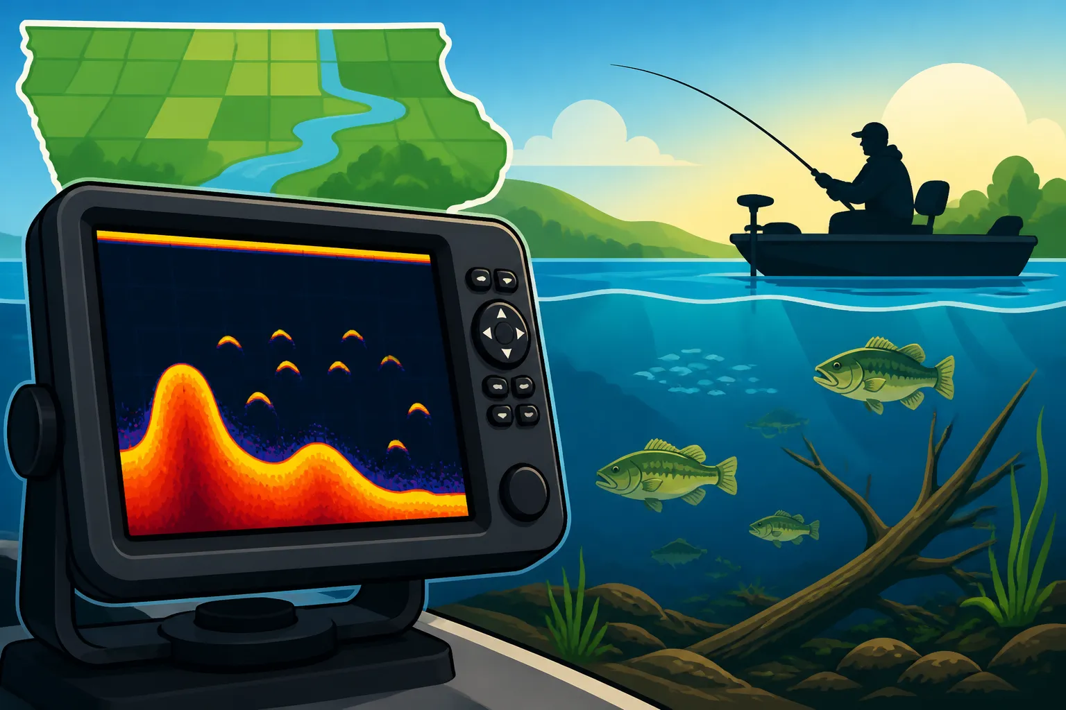
When you see a classic "fish arch" on your fish finder screen, it's not because the fish is shaped like an arch. It's an optical illusion created by the fish moving through the transducer's cone-shaped sound beam. As a fish enters the outer edge of the cone, a faint echo is returned. As it moves closer to the center of the cone (where the signal is strongest), the echo becomes stronger and more distinct, appearing higher on the screen relative to its depth. As the fish moves out of the cone on the other side, the echo fades again, creating that characteristic arch. A full, strong arch usually indicates a larger fish that passed directly under the transducer. Smaller, broken, or partial arches might be smaller fish, or fish that just skirted the edge of the beam.
Sometimes, especially with stationary fish or when your boat isn't moving much, fish might appear as simple lines or even dots. If you see dense clusters of small, fuzzy blobs, you're likely looking at a school of baitfish – often a fantastic indicator that larger predatory fish aren are lurking nearby. Best Live Bait for Iowa Walleye often gather in these schools, attracting the attention of hungry game fish. The key is to pay attention to the consistency, thickness, and location of these marks relative to the bottom or submerged structure.
Understanding Bottom Structure and Contour
The bottom line on your fish finder screen is, naturally, the bottom of the lake or river. But it tells you so much more than just depth! The thickness and intensity of this line provide clues about the bottom composition. A thin, sharp, well-defined bottom line typically indicates a hard bottom, like rock, gravel, or packed sand. These areas are often prime real estate for many species, offering firm footing and potential ambush points. Conversely, a thicker, softer, or fuzzier bottom line suggests a softer bottom, such as mud, silt, or muck. While not always ideal, soft bottoms can hold a lot of insect life and can be important for certain species, especially catfish, which love to cruise Channel Catfish Habitat in Iowa.
Beyond composition, your fish finder is invaluable for mapping contour. As you move, you'll see the bottom line rise and fall, revealing humps, ridges, drop-offs, and ledges. These changes in depth and structure are absolute magnets for fish. A sharp drop-off might be represented by a sudden, steep diagonal line on the screen. A hump will show as the bottom line rising and then falling again. Identifying these features helps you understand where fish might be holding. For example, Walleye Fishing Techniques for Iowa Lakes often involve targeting the edges of drop-offs or submerged humps where walleyes ambush bait. Using the zoom feature can help you get a more detailed look at the bottom composition and subtle changes in contour.
Vegetation, Timber, and Other Submerged Objects
Fish don't just hang out in open water; they love cover! Your fish finder is excellent at revealing various types of submerged structure. Vegetation, whether it's tall coontail, sparse pondweed, or thick lily pads, will often appear as irregular, fuzzy, or "cloudy" masses rising from the bottom. The density and height of the vegetation can vary, showing up as thicker or thinner patches on your screen. Understanding these weed lines is crucial for species like largemouth bass, which use them for ambush and protection.
Timber, such as fallen trees, brush piles, or stump fields, shows up as distinct, often spiky or irregular shapes extending from the bottom. These can be incredibly clear on a good unit. A single log might appear as a solid, dark mass. A brush pile, created by anglers or natural debris, will look like a clump of dense, irregular lines. Rocks, boulders, and even man-made structures like submerged tires or old fishing piers will also have their unique signatures. Learning to differentiate between these types of cover is key to targeting specific species. For instance, Crappie Fishing in Iowa often means finding submerged brush piles or timber, as crappie love to suspend in and around these structures. Even without an advanced unit, understanding these basic interpretations can significantly improve your success.
Advanced Fish Finder Features and What They Reveal
While traditional 2D sonar is fantastic, modern fish finders have evolved to offer even more detailed, photo-like views of the underwater world. These advanced features can truly be game-changers.
Down Imaging and Side Imaging: A Sharper View
Traditional 2D sonar is excellent for covering a cone beneath your boat, but it can sometimes make it hard to distinguish between a fish and a log, or to get a truly clear picture of structure. This is where Down Imaging (sometimes called DownScan) and Side Imaging (or SideScan) come into play. These technologies use higher frequency, narrower beams to create almost photographic-quality images of what's directly beneath (Down Imaging) or to the sides (Side Imaging) of your boat.
Down Imaging works by sending a very thin, high-frequency beam straight down. Instead of arches, fish typically appear as bright dots or streaks, and submerged objects like timber, brush piles, and rock fields show up with incredible clarity and detail, almost like looking at a black and white photograph. You can often see individual branches on a submerged tree. Side Imaging takes this a step further, sending beams out to the sides of your boat, covering a much wider area. This allows you to scan vast sections of water, revealing structure, contours, and even fish holding off to the left or right, well outside your boat's path. Imagine being able to see a school of Bluegill and Sunfish Combined Limit hiding in a weed bed 50 feet to your port side without even driving over them! These technologies are particularly invaluable for scouting new areas or locating subtle pieces of structure in large bodies of water like Fishing Coralville Reservoir in Iowa or Fishing Saylorville Reservoir in Iowa.
GPS and Mapping Integration: Finding Your Way Back
Many contemporary fish finders aren't just fish finders; they're also powerful GPS chartplotters. This integration allows you to combine the real-time underwater view with precise navigational capabilities and detailed maps. The GPS function allows you to mark specific "waypoints" – virtual pins on the map – exactly where you found fish, spotted promising structure, or identified a key depth change. This means if you pass over a brush pile holding crappie, you can mark it, turn around, and navigate right back to that exact spot. This is especially useful when Ice Fishing in Iowa when navigating on large frozen lakes.
Beyond marking individual spots, many units come with pre-loaded maps or allow you to upload highly detailed cartography, sometimes called lake maps or chartplotting. These maps display depth contours, navigation aids, and sometimes even highlight specific types of structure or vegetation. Overlaying your sonar data onto these maps allows for a truly comprehensive understanding of the environment. You can see how fish relate to specific contour lines, how a submerged roadbed trends, or where an old creek channel carves through a reservoir. This combination of real-time sonar and historical mapping data is incredibly powerful for developing strategies and consistently finding productive fishing locations, whether you're exploring Trout Fishing Streams in Northeast Iowa or searching for Rathbun Lake Walleye Fishing spots. Many units from brands like Bass Pro Shops offer this robust GPS integration, helping you not only find fish but also navigate safely and efficiently.
Practical Application for Iowa Anglers
Okay, so you understand the tech and what the screen generally shows. Now, let's bring it back to the water and how Iowa anglers can actually use this knowledge to fill their livewells.
Using Your Fish Finder for Walleye, Bass, and Catfish
Different fish species behave differently, and your fish finder helps you adapt your strategy.
-
Walleye: These cunning predators often relate to deep structure. On your fish finder, you'll want to look for prominent arches or marks suspended just off the bottom near drop-offs, submerged humps, or rock piles. Walleyes are notorious for "hugging" the bottom, so a strong, dark return right above the bottom line could be a prime target. In rivers like the Des Moines, you might look for them along current seams or near wing dams, where your fish finder can reveal subtle changes in depth and current breaks. Walleye often appear as thick, distinct arches. Remember that Walleye Season and Size Limits are strictly enforced, so be mindful of your catch.
-
Bass (Largemouth & Smallmouth): Bass are ambush predators and often relate directly to cover. For largemouth, look for them tucked into submerged vegetation (fuzzy masses on screen), around brush piles, or near timber. They might appear as individual arches sitting right within the cover. Smallmouth bass, especially in rocky rivers or clear lakes, will often be found near hard bottom, rocky ledges, or steep drop-offs. Their arches might be more pronounced in open water, or you might spot them as bright returns tight to rocky structures. Pay attention to how they position themselves relative to the structure; sometimes they're on top, sometimes along the sides.
-
Catfish: Channel Catfish Fishing in Iowa often means looking for deeper holes, channel edges, and areas with softer bottoms or submerged timber, especially in rivers. Your fish finder might show catfish as large, dense individual marks, sometimes near the bottom or suspended in deep scour holes. Flathead catfish, in particular, love to hide in heavy cover like log jams or undercut banks, so you'll be looking for large, distinct returns within or right next to those features. Remember that they might not always arch perfectly; sometimes they'll appear as large blobs or thick lines if they're holding tight to the bottom or structure. For those fishing on the Mississippi River Border Fishing Spots, knowing how to read the deep channels and snags is critical for targeting these big whisker fish.
Maximizing Your View: Settings and Adjustments
Getting the most out of your fish finder isn't just about reading the screen; it's also about knowing how to adjust its settings for different conditions. Think of it like adjusting the focus on a camera.
-
Gain/Sensitivity: This is perhaps the most important setting. It controls how much detail your unit displays. Too low, and you'll miss faint echoes from fish or subtle structure. Too high, and you'll get a lot of clutter (noise) on your screen, making it hard to interpret. In clear Iowa lakes like Clear Lake, you might be able to run a higher sensitivity. In muddy, turbulent river water, you might need to back it off to reduce interference. The goal is to set it as high as possible without introducing excessive clutter.
-
Depth Range: Most units auto-adjust, but manually setting the depth range can give you a more detailed view of a specific depth band. If you know fish are holding between 10-20 feet, setting your range to display only that segment will magnify it, making fish and structure easier to spot.
-
Frequency: Many transducers offer dual frequencies (e.g., 200 kHz and 50 kHz). Higher frequencies (like 200 kHz) provide finer detail and better target separation in shallower water but have less depth penetration. Lower frequencies (like 50 kHz) penetrate deeper and are better for deep water but offer less detail. For general all-around use in typical Iowa depths, 200 kHz is often sufficient, but experimenting with lower frequencies can be beneficial when fishing deep basins in the Fishing the Iowa Great Lakes or searching for Muskie Season and Bag Limit in deeper waters. Many modern units from manufacturers available at Amazon allow you to display both frequencies side-by-side, offering a comprehensive view.
Learning to tweak these settings as water conditions change (e.g., clear vs. turbid water, deep vs. shallow, calm vs. windy) will dramatically improve your ability to find fish. It’s a dynamic tool, and mastering its adjustments is key to unlocking its full potential on any given day.
| Feature | What it shows (Traditional 2D Sonar) | What it shows (Down Imaging) | What it shows (Side Imaging) |
|---|---|---|---|
| Fish | Arches (if moving), lines/blobs (if stationary/small) | Bright dots, streaks, or small, well-defined shapes | Shadows of fish to the sides, appearing as bright spots with dark tails |
| Bottom Contour | Line rising/falling, indicating depth changes | Photo-like rendering of bottom rises, falls, and edges | Detailed, wide-area view of bottom topography to the sides |
| Bottom Hardness | Thickness/intensity of bottom line (thicker=softer, thinner=harder) | Clearer differentiation between hard (bright) and soft (darker/fuzzy) bottom | Distinct textures showing hard vs. soft, rocks, and sand ripples |
| Vegetation | Fuzzy, irregular masses rising from the bottom | Highly detailed, almost photographic view of individual weeds/grass beds | Wide-area scan showing weed lines, patches, and gaps far to the sides |
| Timber/Structure | Irregular shapes, spikes, or dense clusters off the bottom | Sharp, photographic images of individual logs, branches, and brush piles | Detailed, wide-angle images of sunken trees, bridge pilings, and rock fields |
| Bait Balls | Dense, fuzzy clouds of small marks | Compact, often darker clusters of small dots | Visible as masses of small returns to the sides of the boat |
| Range | Cone-shaped coverage directly below boat | High-detail, narrow beam directly below boat | Wide-area coverage to the left and right of the boat (up to hundreds of feet) |
Disclaimer
This article is for general informational purposes only and does not constitute professional advice. Laws, prices and regulations vary by location and change over time. Consult a qualified professional for guidance on your specific situation.