Iowa Fishing Atlas Access Points
There's nothing quite like the excitement of planning a fishing trip, but that buzz can quickly turn into frustration when you’re staring at a map, unsure where you can even legally drop a line. Iowa's beautiful waters are abundant, but knowing exactly where public access begins and private land ends can be a real head-scratcher. This comprehensive guide is here to unravel that mystery, showing you how to unlock the full potential of the Iowa Fishing Atlas to confidently find and explore prime fishing access points across the state.
What Exactly is the Iowa Fishing Atlas?
Imagine having a super-powered map in your hands that not only shows you every public fishing spot in Iowa but also gives you crucial details about those locations. That's essentially what the Iowa Fishing Atlas is – a game-changer for anyone who loves to fish here. It takes the guesswork out of finding a place to wet your line, ensuring you spend less time searching and more time fishing.
More Than Just a Map: Its Purpose and Data Sources
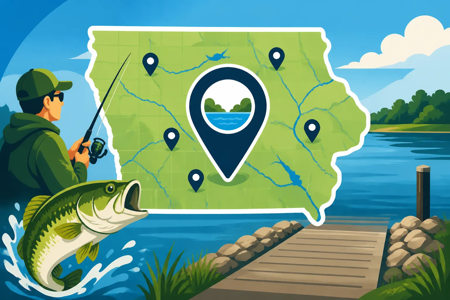
The Iowa Fishing Atlas isn't just a static picture of the state; it's an incredibly robust, interactive online mapping tool developed and maintained by the Iowa Department of Natural Resources (DNR). Its primary purpose is to empower anglers, just like you and me, to easily locate and understand public fishing opportunities while respecting private property.
Think of it as the DNR's way of saying, "Here's all the info you need, go enjoy!" It aggregates a wealth of information from various sources, presenting it in one user-friendly interface. This includes detailed topographic maps, aerial imagery, and overlays showing public land boundaries. But it goes beyond just land features. The Atlas integrates data on various water bodies, identifying specific fish species present, recent fish stocking information, water depths, and even snippets of relevant regulations for certain areas. This means you're not just finding a spot; you're finding a productive spot with all the contextual information you could hope for. It's a digital assistant that helps you plan smarter, making sure you don't accidentally wander into private territory or miss a prime fishing pier.
How It Helps Anglers Find Public Access
For years, finding good public fishing access often meant driving around, looking for "Public Access" signs, or asking locals for advice. While those methods still have their charm, the Iowa Fishing Atlas brings a level of precision and ease that was previously unavailable. It takes the guesswork out of the equation entirely.
First and foremost, the Atlas clearly distinguishes public land from private land, which is absolutely critical for avoiding unintentional trespassing. Anyone who's ever felt the anxiety of wondering if they're in the right spot knows how valuable this is. It uses clear color coding and boundary lines to visually separate areas managed by the DNR, county conservation boards, federal agencies, or other public entities from privately owned parcels. This is especially helpful when you're exploring lesser-known spots or areas that might be a mix of both. Instead of relying on vague directions or hoping for the best, you can see exactly where the public right-of-way exists. The Atlas eliminates that stress by visually laying out all the public access points, from major state parks to small county easements. It also explicitly marks boat ramps, accessible fishing piers, and designated bank fishing areas, which are often the hardest to pinpoint on traditional maps. Understanding your License Rules for Fishing on Private Property becomes much easier when you can clearly see the property lines.
Navigating the Iowa Fishing Atlas: A Step-by-Step Guide
The Iowa Fishing Atlas might seem a bit overwhelming at first glance, given the sheer amount of information it contains. But trust me, once you get the hang of it, it becomes an indispensable tool. It’s designed to be intuitive, and a little guidance can go a long way in making you a power user.
Getting Started with the Online Interface
Accessing the Iowa Fishing Atlas is simple. You'll typically find it hosted on the Iowa Department of Natural Resources (DNR) website. A quick search for "Iowa Fishing Atlas DNR" should lead you directly there. Once you open the Atlas, you'll be greeted by an interactive map of Iowa.
The layout is pretty standard for a mapping application. You'll see the main map display in the center, along with various controls around the edges. There’s usually a legend explaining the symbols and colors, a search bar where you can type in specific locations or water bodies, and a panel or menu dedicated to "layers" – which we'll dive into next. Take a moment to just pan around the map, zooming in and out. You can use your mouse wheel or the +/- buttons on the map interface. The search bar is your friend if you know the name of a lake, town, or river section you want to explore. While it's primarily designed for desktop use, many anglers find it perfectly usable on tablets and even smartphones, making it a great tool for on-the-go planning. It's not a native app, but the web interface usually adapts well to smaller screens, letting you check access points right from your boat or the bank.
Utilizing Layers to Pinpoint Access Points
The true power of the Iowa Fishing Atlas lies in its layers. Think of layers as transparent sheets of information you can overlay on the base map. You can turn them on or off depending on what you're looking for, allowing you to customize the map to your specific needs. This is where you really start to pinpoint those elusive access points.
- Public Lands Layer: This is probably the most crucial layer for finding legal access. When you activate it, different shades or outlines will appear, indicating state parks, wildlife management areas, county parks, and other public domains. This instantly clarifies where you can legally walk, drive, or launch a boat without concern.
- Boat Ramps Layer: Toggle this on, and you’ll see icons pop up marking every public boat launch across the state. Click on an icon, and you often get details like the type of ramp (concrete, primitive), parking availability, and sometimes even a photo. This is invaluable when you're looking for Public Boat Ramps on the Iowa Great Lakes or planning to launch on a smaller, less-known lake.
- Fishing Piers Layer: For anglers who prefer shore fishing or need accessible options, this layer highlights every public fishing pier. These are often great spots for families or those with mobility challenges, providing easy access to deeper water.
- Stream Access Layer: If you're a river or stream angler, this layer will show designated access points for wade fishing or launching smaller craft like canoes or kayaks. These can be trickier to find manually, so the Atlas makes it a breeze.
- Stocked Trout Streams Layer: For the trout enthusiasts, a specific layer highlights all the Trout Fishing Streams in Northeast Iowa that are part of the DNR's stocking program. This layer often includes stocking dates and regulations specific to those waters.
- Fish Species Distribution Layer: While not directly an "access" layer, combining this with access layers helps you target specific fish. If you’re hunting walleye, for example, you can see which lakes or river sections are known to have good populations, then overlay the boat ramp or shore access layer to find a spot to fish them.
By strategically turning these layers on and off, you can quickly filter out irrelevant information and focus on what matters most for your trip. Want to find a pier on a lake stocked with panfish? Turn on the "Fishing Piers" and "Fish Species Distribution" layers and zoom into your area of interest.
Interpreting Map Symbols and Information
Once you've got your layers activated, you'll start seeing a lot of symbols and colored areas on the map. Don't be intimidated; they're all there to help you. The legend, usually found on the side of the map interface, will explain what each symbol and color represents.
Common symbols include specific icons for boat ramps (often a boat silhouette), fishing piers (a pier icon), parking areas (a 'P'), and restrooms. Public land boundaries are typically highlighted with distinct colors or cross-hatching to easily differentiate them from private property. When you click on one of these symbols or a marked area, a pop-up window will often appear, providing more in-depth information. For a boat ramp, this might include details about the ramp material, whether it's suitable for large boats, or if there's a fee. For a fishing pier, it might list the accessibility features or the primary species caught there. For a public land parcel, you might get information about the managing agency, allowed activities, and links to specific regulations. It’s crucial to pay close attention to these details. They often contain critical information about regulations, species, or limitations that could impact your trip. For instance, knowing if a ramp requires a fee or if a specific public area has seasonal closures can save you a lot of hassle. The more you use the Atlas, the faster you'll become at interpreting these visual cues and extracting the valuable information they hold.
Types of Access Points You'll Discover on the Atlas
The Iowa Fishing Atlas is a treasure trove of diverse access points, catering to every type of angler and every fishing preference. From launching a bass boat to simply casting a line from shore, the Atlas will guide you to where you need to be.
Boat Ramps and Launches
For those of us who love the freedom of fishing from a boat, the Atlas is invaluable for locating boat ramps and launches. You'll find a wide variety mapped out, ranging from sophisticated concrete ramps at popular destinations to more primitive launches designed for smaller craft.
Major reservoirs like Fishing Rathbun Lake in Iowa and Fishing Saylorville Reservoir in Iowa typically boast multiple well-maintained concrete ramps with ample parking, perfect for launching larger bass boats or pontoons. The Atlas will clearly mark these, often providing details about the number of lanes, dock facilities, and whether there's an associated fee. But it also highlights countless smaller, often less-used launches on county lakes, rivers, and even remote ponds. These might be gravel ramps, designated shorelines for hand-carry launches (ideal for kayaks and canoes), or simply well-worn paths to the water's edge. When clicking on these icons, pay attention to descriptions that mention "hand-carry" or "primitive," as these might not be suitable for trailered boats. It's also wise to consider current water levels, especially on rivers, as some ramps can become unusable during periods of very high or very low water. Checking the Atlas for ramp locations is the first step in planning a successful boating trip, ensuring you have a safe and legal place to put your vessel in the water.
Fishing Piers and Shoreline Access
Not everyone owns a boat, and honestly, some of the most relaxing and productive fishing can be done right from the bank or a pier. The Iowa Fishing Atlas excels at highlighting these crucial access points, making fishing accessible to everyone.
Fishing piers are fantastic assets. They extend out into the water, often providing access to deeper areas that shore anglers might not otherwise reach. Many piers are designed to be ADA-compliant, offering accessibility for anglers with disabilities. These spots are typically great for catching panfish like bluegill and crappie, as well as channel catfish. The Atlas will show you exactly where these piers are located, often in popular parks or designated recreational areas. Beyond piers, the Atlas also pinpoints general shoreline access points. These can be anything from designated bank fishing areas within state or county parks to public easements along rivers or lakes. For those looking for Shore Fishing Access Near Des Moines, the Atlas will highlight numerous ponds, small lakes, and river sections where you can cast from solid ground. These areas are often equipped with amenities like parking, picnic tables, and restrooms, making them ideal for a family outing. When you're fishing from the bank, pay attention to the marked public boundaries on the Atlas to ensure you're not inadvertently trespassing onto private land. Shoreline access is the backbone of casual fishing, and the Atlas ensures you'll always find a welcoming spot.
River and Stream Access Points
Iowa's rivers and streams offer some fantastic fishing opportunities, particularly for smallmouth bass, walleye, and various catfish species. However, river access can often be more challenging to find due to the dynamic nature of the waterways and the patchwork of public and private lands along their banks. The Iowa Fishing Atlas is an essential tool for navigating these complexities.
The Atlas clearly marks designated public access points along rivers, which might include small boat launches, portage sites for paddlers, or specific areas where public land allows for bank fishing or wading. For instance, if you're keen on finding Des Moines River Smallmouth Bass Spots, the Atlas can guide you to areas with public riverfront parks or easements where you can access the water. Along larger rivers, like the Mississippi, you'll find numerous access points, including boat ramps, public land areas below lock and dams, and specific backwater channels. It’s vital to remember that river fishing often comes with unique challenges, such as strong currents, changing water levels, and sometimes muddy banks. Always check local conditions and be mindful of safety. Additionally, regulations can vary significantly on border rivers. The Atlas can point you to the water, but always consult the Iowa Fishing Regulations on the Mississippi River Border or other specific river rules before you go. The ability to see public land boundaries along these winding waterways is a huge advantage, preventing you from accidentally stepping onto private property while chasing that trophy river fish.
Planning Your Fishing Trip with the Atlas
While the Iowa Fishing Atlas is an incredibly powerful tool, it's most effective when used as part of a broader trip planning strategy. It provides the foundation, but combining its data with real-time information and good old-fashioned common sense will lead to the most successful outings.
Combining Atlas Info with Local Conditions
Think of the Atlas as your master blueprint. It shows you where the access points are, what kind of access they offer, and what species you might find. However, it doesn't always tell you the full story of current conditions. Water levels, recent weather, and fishing pressure can dramatically impact your success.
After pinpointing a few promising access points on the Atlas, take the next step: check recent fishing reports. Many local bait shops or fishing forums provide up-to-date information on what's biting, on what lures, and at which specific spots. A quick call to a local bait shop near your chosen access point can yield invaluable insights into water clarity, current flow, or any recent stocking efforts. You might even use satellite views on Google Maps or Street View to get a visual of the access point itself, checking for parking availability or any potential obstacles. Remember, what looks perfect on the map might be inaccessible in reality due to extreme high or low water. This is especially true for river access points. Also, consider the season. An access point that's buzzing with activity in spring might be entirely different in winter. If you're looking to go Ice Fishing in Iowa, an access point perfect for boat launching in summer might offer excellent walk-on ice access in colder months, but it’s always crucial to verify ice conditions independently.
Legalities and Respecting Private Property
The Atlas is your best friend for avoiding trespassing, but it's important to understand the full scope of respecting property and regulations. The clear demarcation of public versus private land on the Atlas is there for a reason: to keep you out of trouble.
Always double-check the boundaries before venturing off marked paths or into unfamiliar territory. The consequences of trespassing, whether intentional or not, can range from a polite request to leave to legal penalties. It's simply not worth the risk. Beyond legality, there's the broader aspect of angling etiquette. Always pack out everything you pack in – and then some. Leave no trace of your visit. Be courteous to other anglers, boaters, and any nearby landowners. A friendly wave and a respectful attitude go a long way in ensuring continued public access to these precious resources. While the Atlas guides you to legal access, some specific public areas might have additional local ordinances or permits required beyond your standard Iowa fishing license. Always look for posted signs at the access point itself, which might detail parking restrictions, hours of operation, or specific rules about bait or tackle. When in doubt, it’s always best to err on the side of caution or contact the managing agency for clarification.
Leveraging Guided Trips via the Atlas for New Spots
Sometimes, even with the best digital tools, the sheer amount of water and the nuances of fishing can feel overwhelming, especially when exploring new areas or targeting a new species. That's where a local guide can make all the difference, and you can even use the Iowa Fishing Atlas to inform your search for one.
If you’re feeling a bit lost, or you just want to fast-track your learning curve on a particular lake or river, consider booking a guided trip. Guides are professionals who spend countless hours on the water; they know the best spots, the local patterns, and often, the ins and outs of public access points that even the Atlas might not fully convey without local experience. Platforms like FishingBooker are excellent resources for finding reputable, licensed fishing guides in Iowa. You can search by location or target species, and the guides often list the specific lakes or rivers they operate on. Many of these guides utilize the very same public access points detailed on the Iowa Fishing Atlas. They can literally show you how to get to the most productive areas from those public launches or piers, teaching you how to read the water, choose the right bait, and understand local regulations. This can be an invaluable investment, turning what might have been a frustrating search into a highly productive and enjoyable day on the water. A good guide, found through a service like FishingBooker, acts as a living, breathing extension of the Atlas, giving you practical, hands-on experience and unlocking the secrets of Iowa's fishing spots. They'll know the best public launch for a morning walleye bite, or the most productive bank access for catfish after a rain.
Advanced Tips for Maximizing the Iowa Fishing Atlas
You’ve mastered the basics, now let’s talk about taking your Iowa Fishing Atlas game to the next level. These advanced tips will help you fine-tune your search, plan more strategically, and even stay connected when you're off the grid.
Using the Atlas for Species-Specific Spot Selection
One of the most powerful features of the Iowa Fishing Atlas, often overlooked by beginners, is its ability to help you locate fishing spots based on the species you want to target. This goes beyond just looking for a "lake" and hoping for the best.
Let's say your heart is set on Walleye Fishing in Iowa. You can activate the "Fish Species Distribution" layer on the Atlas. This layer uses color-coded areas or specific icons to indicate where walleye populations are strong or where they are regularly stocked. Combine this with the "Boat Ramps" layer, and you can quickly identify the best lakes or large river sections with walleye, along with the most convenient places to launch your boat. Similarly, if you're chasing Rainbow Trout Fishing in Iowa, you'd activate the "Stocked Trout Streams" layer. This not only shows you the streams but often provides links to stocking schedules. Knowing which streams have been recently stocked can give you a significant edge, as newly introduced trout are often more eager to bite. The Atlas can also reveal habitat types. By looking at the aerial imagery or topographic maps, you can identify structure (like submerged islands, drop-offs, or river bends) that tend to hold specific fish species, then cross-reference with public access points nearby. This level of detailed planning ensures you're not just fishing anywhere, but fishing where the fish are most likely to be, and doing so from a legal access point.
Mobile Use and Offline Access
While the Iowa Fishing Atlas is a web-based tool, that doesn't mean you can't take it with you on the water. Many anglers find it incredibly useful to reference the Atlas on their smartphone or tablet while actively fishing.
The web interface is generally responsive enough to be used on mobile browsers. This allows you to check nearby access points, verify public land boundaries if you decide to explore a new area on the fly, or quickly look up species information for a body of water you just arrived at. However, let's be realistic: Iowa has plenty of rural areas where cell service can be spotty or non-existent. To combat this, a smart strategy is to plan ahead. Before you head out, zoom into your target fishing area on the Atlas and take screenshots of the key sections, including access points, public land boundaries, and any relevant details. You can save these images to your phone for offline reference. Some anglers even use dedicated mapping apps on their phones that allow for offline map downloads and can overlay custom points from the Atlas. While the Atlas itself doesn't have an "offline mode," this workaround ensures you're never without critical information, even when you're deep in the wilderness. Having the Atlas information at your fingertips, whether online or offline, empowers you to make informed decisions and adapt your fishing strategy as conditions change throughout your day.
| Access Type | Ideal For | Key Features | Considerations |
|---|---|---|---|
| Boat Ramps | Boating anglers (all boat types) | Concrete, gravel, or primitive launches; parking often available | Water levels, trailer parking, launch fees, boat size limits |
| Fishing Piers | Shore anglers, families, accessibility needs | Extends into deeper water, often paved/accessible, benches, railings | Can be crowded, limited casting range, specific fish common |
| Shoreline Access | Bank fishing, wading, kayaking/canoeing | Designated public banks, parks, easements, walk-in access | Varying terrain, need to confirm public land boundaries, current |
| River/Stream Access | River anglers, waders, kayakers | Specific launch points, public land along riverbanks, portage sites | Strong currents, changing water levels, specific river regulations |
| Community Ponds | Beginners, families, quick trips | Often stocked, easy access, urban/suburban locations, amenities | High fishing pressure, smaller fish, specific local rules |
Disclaimer
Please remember that fishing regulations, access points, and local conditions can change. While the Iowa Fishing Atlas is an excellent resource, it is always your responsibility to verify current regulations with the Iowa DNR and respect all private property laws. Fishing involves inherent risks, so always prioritize safety, especially when on or near the water.